Modernization
Learn more about government’s intention to modernize the museum to protect our historic holdings and provide better access to our collections.
Event hosted by: Friends of the BC Archives
Guest Speaker: Maycira Costa
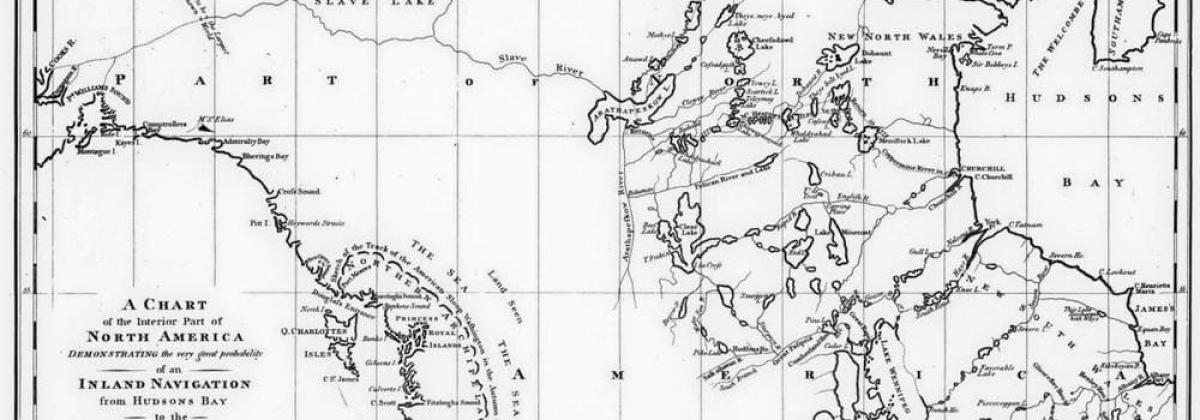
What can archival records tell us about historic ecosystems and ecological change over time? Dr. Maycira Costa offers one answer. In this presentation, Dr. Costa will describe how she combines British Admiralty charts (1858-1956) and satellite imagery to map changes in BC’s kelp forests. Kelp provides the basis for one of the most productive and complex coastal ecosystems in the world, earning it a reputation as the “rainforest of the ocean.” Kelp helps sustain marine food webs, buffers shorelines against erosion, and contributes to carbon and nitrogen cycling. But the history of BC’s kelp forests is far from simple. Local studies show different patterns of change across the coast, from total losses in some areas to ongoing resilience in others. Dr. Costa’s presentation will shed light on these changes, while also demonstrating how historic records shed invaluable light on our changing environment.
Dr. Maycira Costa is an Associate Professor of Geography at the University of Victoria, with a background in oceanography, remote sensing, and geography. Dr. Costa runs an interdisciplinary research lab that uses satellite images to examine coastal waters, rivers, and wetlands. Her previous fieldwork ranges from the BC coast to the Amazon—guess which one was warmer to swim in! Her work with Admiralty charts has been spotlighted by the CBC, Chek News, National Observer, and Toronto Star.
Tickets: Please visit https://friendsofbcarchives.wordpress.com/upcoming-events/
Contact: info@friendsbcarchives.ca